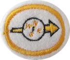
Orienteering
Orientation used to be part of the Nature category, but was changed to the Recreation category.
Este conteúdo não está disponível em sua língua ainda.
1. Explain what a topographic map is, what you expect to find on it, and three uses for it.
2. Identify at least 20 signs and symbols used on topographic maps.
3. Give the nomenclature of an orienteering compass.
4. Know the meaning of the following terms:
5. Demonstrate how to shoot a magnetic azimuth.
6. Demonstrate how to march on a magnetic azimuth.
7. Know two methods to correct for declination and when correction is necessary.
8. Be able to orient yourself and a map by inspection and by compass.
9. Explain resection and its use.
10. Prove your ability in the use of a map and/or a compass by following a one-mile (1.6 km) cross-country course with at least five given readings or control points.
1. Have a 1/25000 map of your area and :
2. Have a good compass and know how to :
3. On the field :
4. Finding your way without a compass by
5. Know how to program the route on a GPS and follow its directions
A especialidade equivalente aprovada por outras entidades, com seus próprios requisitos:
Esta especialidade conta para:
Esta especialidade é obrigatória, sugerida ou opcional em:
Modelos anteriores desta insígnia. Veja todas as insígnias desatualizadas.
Orientation used to be part of the Nature category, but was changed to the Recreation category.
Encontrou um erro? Informe-nos.